Japan provides an unusually large amount of public information on natural-disaster risk.
The difficulty is not that the information does not exist. It is knowing where to look, which layer matters, and what a coloured area actually means for a specific property.
When we review a property, we do not rely on one map. We look at the present hazard designation, the underlying ground, the history of the land and the detailed information published by the municipality.
The objective is not to find a property with zero risk. It is to understand the risks before paying for them.
A hazard map should not tell you whether to buy a property. It should tell you what to investigate next.
Four risks to check first
| Risk | What it means | What to look for |
|---|---|---|
| Liquefaction | Water-saturated soil may temporarily lose strength during strong earthquake shaking. | Landform, former waterways or reclaimed land, site investigation and foundation design. |
| River flooding | Water enters the area when a river overtops or flood-control structures fail. | Modelled depth, duration, building-collapse zones and evacuation routes. |
| Inland flooding | Heavy rain exceeds the capacity of drains, sewers and pumps. | Local low points, basement exposure and the municipality’s inland-flood map. |
| Landslide / cliff risk | Steep-slope failure, landslides or debris flows may affect the site. | Yellow or red designated zones, retaining walls, drainage and building restrictions. |
These risks should be checked separately. A property far from a major river may still experience inland flooding. A building that meets modern seismic standards may still stand on ground with liquefaction potential. A slope that looks distant on site may still overlap part of the legal parcel.
Step 1 — Start with a broad ground-risk screening
The Jiban Support Map is a useful first screen. After entering an address, users can review several layers in one place, including ground characteristics, earthquake-related information, flooding, historical aerial imagery and landslide information.
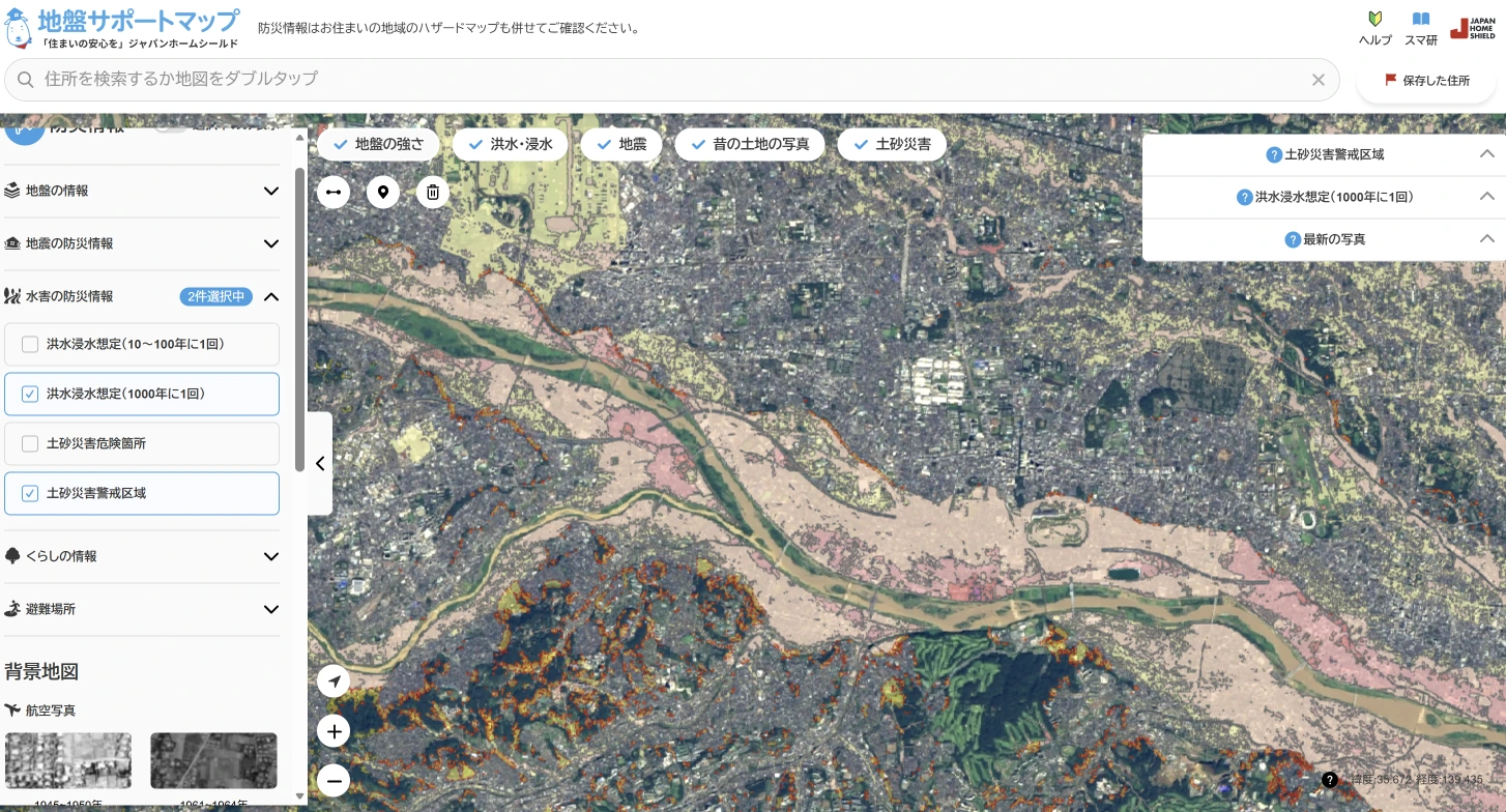
Use this stage to form questions rather than reach a conclusion:
- Does the site appear to be on low-lying or historically wet ground?
- Is liquefaction potential indicated?
- Are flood or sediment-disaster layers close to the parcel?
- Do the aerial and historical views suggest major land alteration?
This remains a screening tool. It is not a substitute for site-specific geotechnical investigation, soil-boring data or review of the building’s foundations.
Step 2 — Cross-check the official national portal
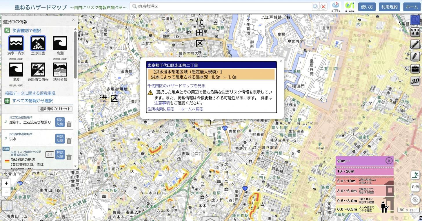
Next, open Japan’s official Hazard Map Portal Site. Its Kasaneru Hazard Map, or Overlay Hazard Map, allows users to search a location and display flood, inland-flood, storm-surge, tsunami, landslide and landform information on one map.
Turn the layers on one at a time. If everything is displayed together, the screen can become difficult to interpret.
For flood exposure, do not stop at whether the property is inside a coloured area. Check:
- the modelled inundation depth
- the assumed type of flooding
- expected flood duration, where available
- whether the site is in a building-collapse risk zone
- the location of evacuation facilities and viable routes
A modelled depth of less than 0.5 metres is a different physical problem from three metres. The building matters too. A tenth-floor condominium unit is less directly exposed than a ground-floor house, but the condominium may still lose access, electricity, lifts, parking or ground-floor equipment.
The distinction between river flooding and inland flooding is especially important in Tokyo. Inland flooding occurs when intense rain overwhelms urban drainage; the river does not need to overflow. Checking only the river-flood layer can therefore miss a material risk.
No colour on the national map should be read as proof of “no risk.” Official data coverage, assumptions and publication dates vary, which is one reason the local-government check comes next.
Step 3 — Look back in time
Modern Tokyo can conceal its original geography. Apartment buildings and paved roads may now stand where there were once fields, wetlands, waterways, coastline or reclaimed land.
Konjaku Map on the Web places historical topographic maps beside modern mapping. It can help explain why a present-day hazard appears in a particular location.
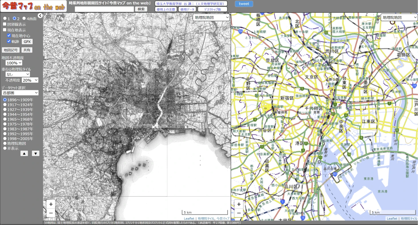
The useful question is not simply, “Was this once a rice field?” It is, “What should that history lead us to verify?”
- A former river or waterway may prompt a closer look at low terrain, drainage and liquefaction.
- Former coastal water or reclaimed land may prompt checks of liquefaction and storm surge.
- A former wetland may justify closer review of soil and groundwater conditions.
- Cut-and-fill development or old slopes may lead to questions about retaining walls and land alteration.
Historical land use is an indicator, not a verdict. Modern piling, soil improvement and foundation design may materially change the performance of an individual building.
Step 4 — Go one level deeper: check the municipality
The national portal is an excellent starting point, but it should not normally be the last step.
Use the portal’s Wagamachi Hazard Map service to find maps published by the relevant municipality. Under Japan’s disaster-information framework, municipalities in areas covered by the relevant statutory designations must make specified hazard and evacuation information available to residents. The exact maps, online format and translated content are not uniform nationwide.
Local sources may provide:
- more detailed flood or inland-flood assumptions
- evacuation shelters and routes
- recent revisions and local infrastructure information
- legally designated sediment-disaster zones
- downloadable maps and disaster guidance
Many larger municipalities provide English or multilingual information, although the depth of translation varies.
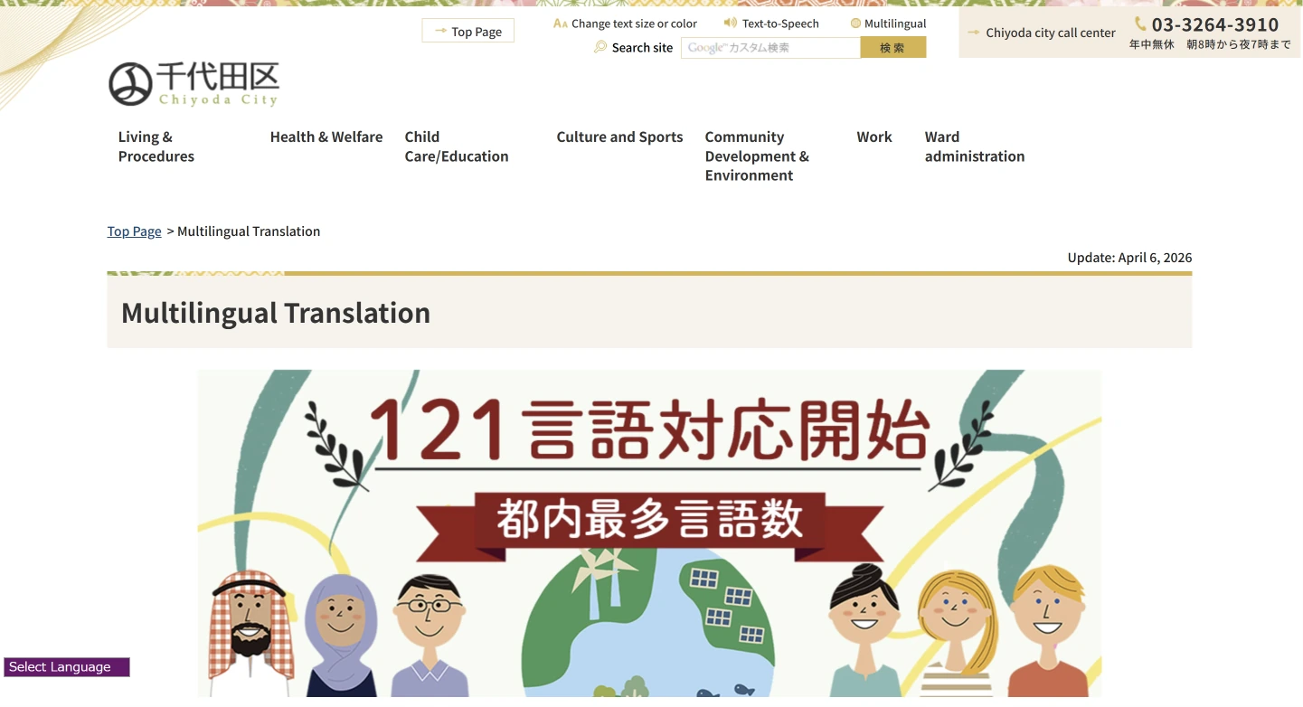

Chiyoda City is one example of a municipality offering multilingual access. Translation availability does not mean that every technical map or document is fully translated, so the Japanese source should still be checked where necessary. Source: Chiyoda City.
The practical sequence is:
Why this matters for value and financing
Natural-hazard risk is not only a safety issue. It can become a question of insurance, collateral, future demand and resale liquidity.
Since 2020, Japanese real-estate brokers have been required to show the approximate location of a transaction property on the latest available municipal water-hazard map prepared under the Flood Control Act. The requirement covers river flooding, rainwater flooding and storm surge. The government also cautions brokers not to imply that a property has no water risk merely because it is outside a mapped inundation zone.
That matters for an owner because the next buyer may be shown the same information when the property is sold.
Financing is more nuanced. There is no universal rule that a coloured hazard zone means a mortgage will be rejected or that a fixed loan-to-value reduction will apply. Policies differ by lender, borrower and asset.
However, Japan’s Financial Services Agency reported in 2026 that financial institutions increasingly analyse wind and flood risk, and that some apply measures such as checking insurance coverage or reflecting higher risk in collateral assessment. Bank of Japan research has also identified falling collateral value as one channel through which flood risk may affect banks.
The correct conclusion is therefore:
A hazard zone is not a buy / do-not-buy signal
Many established and valuable parts of Greater Tokyo have some natural-hazard exposure. Rejecting every coloured area would remove a substantial part of the market.
The more useful framework is:
Risk × Building × Price × Insurance × Exit
What type of event is modelled, and how severe is it?
How do the structure, floor, foundations, equipment and access change the exposure?
Is the additional risk reflected in the acquisition price and expected return?
Is adequate insurance available to transfer part of this risk away from the owner, and at what cost?
Could the issue affect financing, tenant demand or future resale?
A flood-zone property may still be an excellent asset. A property outside the main hazard zones may still have serious legal, structural or management problems. Hazard is a variable in valuation, not a binary veto.
Maps are the beginning of due diligence, not the end
With an address and a computer, an overseas buyer can investigate far more than many people realise.
But a map cannot tell you everything about an individual property. Depending on the asset, the next review may include foundation records, retaining walls, drainage, building permits, completion certificates, seismic standards, repair history, insurance, road access, rebuilding restrictions, leases and management documents.
Japanese real estate contains many layers of information, and not all of them are available in English. This is why local professional review matters before a purchase decision is finalised.
At AOKI LIVING LLC, we approach property from the perspective of both real-estate practitioners and long-term owners. The objective is not to eliminate every possible risk. It is to understand how the land, building, price, intended use and future exit fit together before you own the asset.
Review a Property Before You Buy
AOKI LIVING LLC supports international buyers reviewing residential and income-producing property in Greater Tokyo, including location, hazard exposure, ownership structure, building condition, management and long-term asset considerations.
View Selected Properties Request a Private ConsultationReference Tools and Sources
MLIT / Geospatial Information Authority of Japan — the official Kasaneru (Overlay) Hazard Map and Wagamachi Hazard Map.
Japan Home Shield — broad ground-risk screening tool covering flood, sediment-disaster and historical land information.
Kenji Tani, Saitama University — historical topographic maps placed beside modern mapping.
Ministry of Land, Infrastructure, Transport and Tourism — the disclosure requirement introduced in 2020.
How financial institutions are analysing wind and flood risk in lending and collateral assessment.
Research on flood risk and collateral value as a channel affecting bank financial conditions.
This article is provided for general information only and does not constitute engineering, legal, investment, insurance, lending or disaster-prevention advice. Hazard information, map coverage, modelling assumptions and official designations may change. Each property should be reviewed individually using current official information and qualified professional advice where appropriate.